|
Air
Pollution and Climate Modeling
ERG has developed
several models used for high-spatial resolution estimates of the transfer
of air pollutants, CO2, and water vapor between the atmosphere
and the land surface in complex terrain. We can modify and apply these
models to meet your needs for estimates of pollutant deposition, net carbon
assimilation and evapotranspiration.
|
Air Pollution and
Meteorological Measurements
We design, deploy, and
maintain environmental measurement systems for climate monitoring, air
pollution monitoring, and trace gas flux measurement by micrometeorological
methods. We conduct measurement programs in conjunction with model
development for specific applications and locations. We also can train your
staff to operate a measurement system and provide software tools for data
analysis.
|
|
Ecosystem
Measurements and Modeling
ERG develops and applies
models for simulating ecosystem processes and biogeochemistry at the stand,
watershed, and regional level. We also make the field measurements and
develop the geospatial databases necessary to parameterize and validate
models.
|
GIS,
RS, Spatial Analysis and Modeling
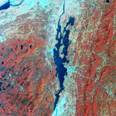
We provide a broad range
of GIS and spatial analysis services including: geospatial database design
and development, development of custom spatial analysis and modeling
software, distributed ecosystem process modeling, interpretation of
remotely sensed imagery, ground-truth assessments, ecosystem inventory,
cartographic design and production.
|